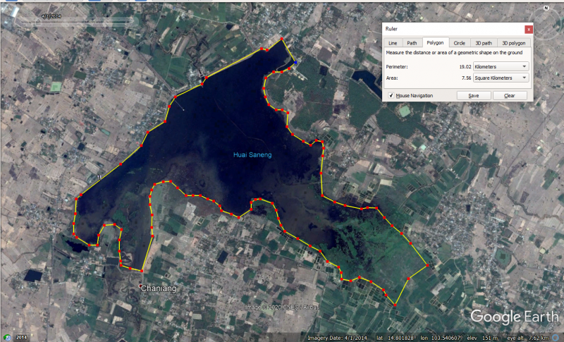
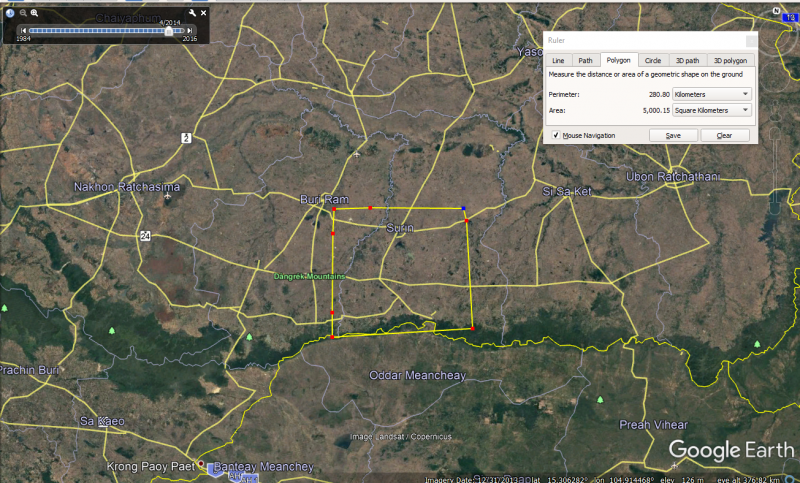
I am not questioning your maths, although I am questioning the surface area of the reservoir. Some 5,000 square kilometers, which to keep it simple, is just a little larger than a square measuring 70 x 70 kilometers, i.e. 4,900 square kilometers. However, the Huai Saneng reservoir is not a square and more like a letter 'T. At best the T measures 5 x 5 kilometers. Even if the reservoir was a square, with 5 kilometers sides, the maximum surface area would be 5 x 5 = 25 square kilometers. This falls far short of the 5,000 square kilometers used in your calculations. It does, therefore, suggest your later calculations are way over the top.
View attachment 35930
My source of information is Google Earth, with measurements taken with the built-in ruler tool.
P.S. A 70 kilometer side, as required for 5,000 square meters, when drawn in a straight line, would run from Surin, beyond Kap Cheong, and over the border to Cambodia. The reservoir is not that big.


